Sunday, May 12, 2013

Valley of the Gods, Cedar Mesa, Utah


Tucked away in SE Utah just north of Navajo Nation and Monument Valley is this little gem.  Valley of the Gods.  We drove the 17 mile dirt road across various washes and through the formation.  Some say there are gods in the rocks!  Not sure but quite beautiful
Over view of Valley of the Gods

one of the formations

Someone taking pix on her iPhone

Here is what we were shooting.  Some Flowers shooting up from some flavor of miniature Yucca plant

Looking the other way from the Valley of the Gods.  what the Gods see.

- blessings from the road

Saturday, May 11, 2013

Escalante

Grand staircase Escalante is amazing place.
I haven't had cell service until now in Ely Nevada so am posting a few pix.
Oops, forgot to post this so now am catching up. S took off early to drive through Capital Reef NP and ended up over on other side of mountain.  So I drove over the 9400 ft mountain pass in storm conditions.  fortunately the storm was warm enough to not cause snow and hail to stick.  Was beautiful.  here are a few pix.
Driving over Boulder Mountain into teeth of storm en route to Escalante.  Aspens just budding out
Overlooking Grand Staircase Escalante looking south from north side
Looking east towards the Water Pocket fold of Capital Reef
After encamping in Escalante, we drove down Hole in the Rock road about 15 miles. (45 miles long).  Storm brewing and late in day.
Some hoo doos in Devil's Garden down Hole in the Rock road south of Excalante town
Another vision of the hoo doos in Devil's Garden
- blessings from the road

Friday, May 10, 2013

Nevada Northern Railroad.

Here in Ely, Nevada, Nevada Northern Railway is a fullly working historic railroad museum and Ghost Train.

We stopped here during our westward journey on highway 50 so I could make a conference call.
While waiting for call, we toured throughout the place. Here are some iPhone pix and video.


YouTube Video


YouTube Video


blessings from the road

Location:Avenue A,Ely,United States

Great Basin national Park

Seated at the base of Peak, theist famous part is the Lehman limestone caves. We took a 90 minute tour inside the 1.5 mile long cave. Wow. Here are some iPhone pix.
I shotth without flash using my ProHDR app. Enjoy


- blessings from the road

Wednesday, May 8, 2013

Oh boy. New tires... And shocks.

Oh boy. We pulled into Beaver, Utah off I-15 to get gas and to turn west to Great Basin national park.

We noticed the front tire had a real problem. See pic below.


We had planned to replace the tires this summer anyway and this option was better than getting stuck out in middle of Nevada or hava blowout. So off the tires come. ALL 6 OFTHEM.


Charli has the front tires off here.


Turns out the shocks were bad and making the tires bounce.Plus 7 yr old tires the inside bands were cracked and expanding.


So now we have new shocks and new tires.
A rather expensive day (don't ask) however we are fortunate this didn't happen on the road.

- blessings from the road

Location:UT-160,Beaver,United States

Tuesday, May 7, 2013

Capital Reef National Park

Driving in from the southeast we get a feel for the 100 mile long "waterpocket fold" that lifted up the land 5,000-7,000 feet about 65 million years ago.  The sun was hazy and cloudy so no good pics that day.  We camped in Fruita campground near visitors center fortunate to have arrived before noon and nabbed the last campsite in park.  whew.  Enjoyed the area and sat outside to eat our dinner that evening as the wind whipped up building up some fun weather.  next day found us with some sprinkles and drizzle which began to bring out the color. 
Me photographing Eaton's Penstemon (photo by Sraddha iphone)

I am sitting in an internet cafe in Torrey, UT,  typing as fast as I can because Sraddha headed out before dawn to drive the west side of the park and ended up 30 miles away at Anazazi Ruins state park in boulder, Utah where I am headed when I finish this blog post.  


Alive and well in south central UTAH (not LA,,hehe). Just departing Capital Reef National Park en route to Bryce Canyon NP. what a gem is Capital Reef and very secluded. The weather has turned cool and rainy with snow in high country. for a photographer, this has been a blessing as the colors of everything no longer washed out in the hot sun. here are some samples. This rainbow showed up in our back window and we immediately stopped to shoot the pic.


Rainbow looking south

Grand Castle

Golden Throne

No need for caption.  View says it all


Wildflowers just beginning to bloom in Capital Reef NP. Apparently there are some rare species in area. Not sure we saw any but we were fortunate to get a few photos. 2 different penstemons.


Eaton's Penstemon

Utah Penstemon


Saturday, May 4, 2013

Valley of the Gods, Cedar Mesa, Utah

 Well this pretty much says it all
Valley of the Gods lies Northeast of Monument Valley, just over the Utah Border on the south edge of Cedar Mesa which rises up 1200 ft above the canyon floor


south edge of Cedar Mesa in Southern Utah
Valley of the Gods
Had seen a photo in Bluff coffee shop entitled House on Fire.  Very famous apparently so we went to track it down. Discovered it was in Mule Wash in northern part of Cedar Mesa, so we went looking for it.  Hiked about 3 miles up the canyon.   Ruins pretty cool. Photographed what I thought was the shot but was the wrong one.  Sigh.  Turns out the ruins I wanted was in South Mule Wash, not North Mule Wash.  Still a fun hike of 6 miles with only 2 blisters (need new shoes).


Anyway posting the shot I did get here and will have to return another year. 


Also saw this collared lizard peeking out of its hideaway as we returned to the car.

Collared Lizard


Canyon de Chelly Amazing and deeply spiritual place

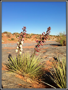
For over 30 years, Sraddha has dreamed of visiting Canyon de Chelly.  We tried 2 other times but had to forego the visit mainly due to time and distance.  This time we planned our northward journey route right through.  We departed Catalina State park after an extended visit wherein I had flown home to keep a presence at office in Ananda Village as I do regularly while traveling.  Sraddha enjoyed her time exploring, hiking, visiting friends.  During this time, the founder of our Ananda Village community, Swami Kriyananda, passed away.  As a result and for some other reasons I will share later, we elected to cut our 3 month trip short foregoing New Mexico until next winter and head home a month early.

Tunnel Overlook
We postponed our departure one day because the Camera Club of Tucson was holding a photoshoot early Sunday morning which I wanted to attend.  See link here for photos.

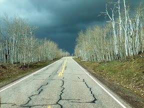
We drove up the eastside of Arizona through Oracle, Globe landing in Holbrook, Arizona, late in afternoon.  Found an RV park where we could get the Verizon mifi working "ok" so could check email and catch up on Monday business.  Nice to have easy drive but some personal business things kept us busy, so no blogging.

Wind had whipped up during our trip north the next day from Holbrook to Chinle on the Navajo Nation. Beautiful trip through stark red rock washes.  Glad it was behind us most of the way.  Arriving in Chinle, we drove over to the campground near the visitor's center.  Canyon de Chelly National Monument was established and seems to be maintained by the Park service, however the visitor center, and campgrounds seem to be run by local Navajo natives.  Anyone can drive along the north and south roads which overlook the 2 main canyons running east/west to form a "Y" at the western end just outside Chinle.

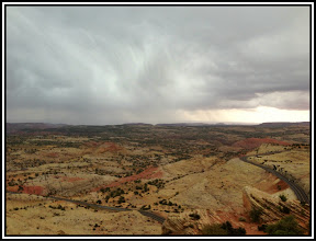
Once camped, we braved the howling 40 mph winds to drive along the south rim with 7 overlooks. Dust had really kicked up by now which made the canyon look almost ethereal.

The next day, in order to enter into the canyon through the west, we had to hire a native guide.  We chose Antelope House tours and our guide's name was Brandon.  He is a young native american man whose great-grandfather drove wagons with horses through the canyon and whose mother owns some land way up canyon.  We visited this land as well as his Auntie's land called "Antelope House" where we got some native fry bread as our lunch.

With Brandon as our guide we set off into the canyon right down through the running creek bed.  He was a little like a riverboat pilot navigating the sandbars and quicksand.  I would have been stuck in 5 minutes without him.  Glad he was there.

Entering a river crossing.  road to left of tree
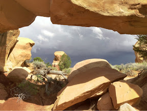
Not sure how far we drove up the north canyon, or "Canyon del Muerto" (Canyon of the dead).  Think about 12 miles or so.  This canyon has been occupied since the Navajo existed and way before with Anazazi indians and many other descendent tribes.  Mostly co-exising peacefully until arrival of Spanish bout 300 yrs ago (Not clear on my history but around then).

The Spanish arrived and saw the beautiful walls of the buildings built up in the rocks that were coated with  "gold-like" mixture which they thought was gold.  Such a fixation they had for gold so they raided the people and caused all kinds of issues.  Anyway, the natives have been farming this land for 100's if not 1000's of years which was obvious from the many ruins high up on the cliffs.  These ruins age ranged from 500-1000 yrs depending on how high up the cliff's.  The water had carved out the canyon since thereby lowering the canyon floor.  Water had moved the sand/silt down river so more often than not, the canyon walls went right down to the canyon floor.

All in all, it was a very fun long day.  I drove about 30 miles through the canyon floor with 45 river crossings.  more pix here

Digging out from sand.  took about 30 minutes
Oh yes, we did get stuck once.

Now onto SE Utah